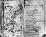
A map by Nathaniel Bowditch appeared in the 1802 edition of The American Practical Navigator. He was working for or with Edmund March Blunt in an attempt to create a better reference book for Mariners. I have posted pictures of a hand drawn map I'd purchased 15 years ago onto a webpage located at http://www.geocities.com/mapmakerz777/index.html This map appears to be similar in many respects to the map found in the 1802 edition of The American Practical Navigator. It also bears the logo used by the E & G W Blunt firm in the upper left corner. The Prime Meridian on my map is Greenwich. On the 1802 map it is London. Is anyone familar with the handwriting of Nathaniel Bowditch? I am trying to determine whether or not this manuscript map was created by him. The only identifying mark is a number 96.
replied to: mapmakerz777
Replied to: A map by Nathaniel Bowditch appeared in the 1802 edition of...
I have a hand drawn chart very much like the one you have posted. The Chart I have is 24 3/4 by 15 1/2 & is colored. Louisiana is spelled Louisiannah & there are corrections on the map. I've had it looked at by a map seller who thinks it is around the very early 1800's but who has referred me to the Huntington Library. I can send you some photos in JPG format if you would like. I would like some close up
replied to: Cat5rj45
Replied to: I have a hand drawn chart very much like the one...
Hi
I've noticed some details on my manuscript chart that seem to connect it to both the 1802 and 1831 charts by Blunt. Annapolis is spelled Annapolis on the 1802 chart and Anapolis on the 1831 chart. My manuscript chart has Annapolis spelled with two n's and one of them is crossed out. Whoever drew it just scribbled on one of the n's. The journey depicted on the 1802 chart also appears on the manuscript chart. On the 1831 chart the dotted lines appear in the area of Madeira only. I've been told it wasn't uncommon for mapmakers to revise copper plates that had been used to create earlier maps. Perhaps that was done in this instance. Did you view the images posted on the site referenced in my earlier post? What would you like close-up images of? Let me know what part of the chart you'd like to see in greater detail and where to send the images.
replied to: mapmakerz777
Replied to: Hi
I've noticed some details on my manuscript chart that...
No I don't need any more images. I took a better look at your photos. You can see the Chart that I bought on eBay at http://cgi.ebay.com/ws/eBayISAPI.dll?ViewItem&item=390037034823&ssPageName=ADME:X:RTQ:US:1123
I have better JPG's that I took when I received the Chart. I would also like to see some of his handwriting to compare with the Chart I have. I did find a letter on line but it was dated Nov 3 1835 much later on in his life which would account for the differences.
replied to: mapmakerz777
Replied to: Hi
I've noticed some details on my manuscript chart that...
Sorry here is the link to his handwriting:
http://www.historyforsale.com/html/prodetails.asp?documentid=250695&start=19&page=153